


Voting District 40160, Imperial County, California
About
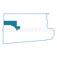
Outline

Summary
| Unique Area Identifier | 531081 |
| Name | Voting District 40160 |
| County | Imperial County |
| State | California |
| Area (square miles) | 251.83 |
| Land Area (square miles) | 175.63 |
| Water Area (square miles) | 76.20 |
| % of Land Area | 69.74 |
| % of Water Area | 30.26 |
| Latitude of the Internal Point | 33.15132480 |
| Longtitude of the Internal Point | -115.81770300 |
Maps


Graphs
Select a template below for downloading or customizing gragh for Voting District 40160, Imperial County, California


Neighbors
Neighoring Voting District (by Name) Neighboring Voting District on the Map
- Voting District 22977, San Diego County, CA
- Voting District 30085, Imperial County, CA
- Voting District 30105, Imperial County, CA
- Voting District 40120, Imperial County, CA
- Voting District 40121, Imperial County, CA
- Voting District 40125, Imperial County, CA
- Voting District 40130, Imperial County, CA
- Voting District 40145, Imperial County, CA
- Voting District 56658, San Diego County, CA
Top 10 Neighboring County Subdivision (by Population) Neighboring County Subdivision on the Map
- Brawley CCD, Imperial County, CA (26,008)
- Calipatria-Westmorland CCD, Imperial County, CA (12,248)
- West Imperial CCD, Imperial County, CA (10,389)
- Borrego Springs CCD, San Diego County, CA (4,440)
- East Imperial CCD, Imperial County, CA (1,266)
Top 10 Neighboring Place (by Population) Neighboring Place on the Map
Top 10 Neighboring Elementary School District (by Population) Neighboring Elementary School District on the Map
- Brawley Elementary School District, CA (25,664)
- Westmorland Union Elementary School District, CA (2,606)
Top 10 Neighboring Secondary School District (by Population) Neighboring Secondary School District on the Map
Top 10 Neighboring Unified School District (by Population) Neighboring Unified School District on the Map
- Coachella Valley Unified School District, CA (85,553)
- Calipatria Unified School District, CA (10,397)
- Borrego Springs Unified School District, CA (3,869)
Top 10 Neighboring State Legislative District Lower Chamber (by Population) Neighboring State Legislative District Lower Chamber on the Map
Top 10 Neighboring State Legislative District Upper Chamber (by Population) Neighboring State Legislative District Upper Chamber on the Map
Top 10 Neighboring 111th Congressional District (by Population) Neighboring 111th Congressional District on the Map
Top 10 Neighboring Census Tract (by Population) Neighboring Census Tract on the Map
- Census Tract 123.01, Imperial County, CA (5,633)
- Census Tract 101.02, Imperial County, CA (5,007)
- Census Tract 123.02, Imperial County, CA (4,756)
- Census Tract 210, San Diego County, CA (4,440)
- Census Tract 102, Imperial County, CA (2,640)
- Census Tract 124, Imperial County, CA (1,266)
- Census Tract 103, Imperial County, CA (933)
Top 10 Neighboring 5-Digit ZIP Code Tabulation Area (by Population) Neighboring 5-Digit ZIP Code Tabulation Area on the Map
- 92227, CA (26,234)
- 92274, CA (19,801)
- 92233, CA (8,099)
- 92004, CA (3,881)
- 92281, CA (2,432)
- 92257, CA (2,326)
- 92275, CA (1,506)